Big fun! A quick clip that AARP’s Life Reimagined produced about us! It’s 30 secs of GypsyNester action-packed goodness! What do you think? Leave a comment here!
Big fun! A quick clip that AARP’s Life Reimagined produced about us! It’s 30 secs of GypsyNester action-packed goodness! What do you think? Leave a comment here!
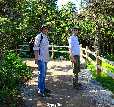
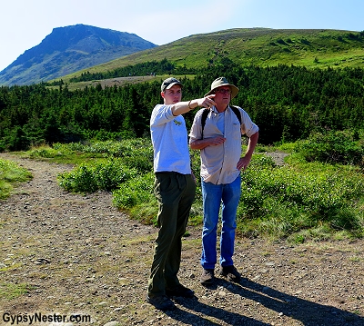
We were going to hike up a mountain, The Boy said. Not climb, hike.
Or maybe that’s what I chose to hear. Certainly, The Boy is aware of my age and the limitations thereof.
He wouldn’t be trying to kill me on my birthday, would he?
We woke to a beautiful day in Anchorage, a bit jet lagged, but nothing serious. The Boy was rarin’ to go; I’d never been to Alaska — his new home — and he was ready to show it off.
I was excited to spend an idyllic day in nature with my husband and son; walking, talking and reconnecting after a few months of mommy withdrawals.
And that’s exactly how it started out.
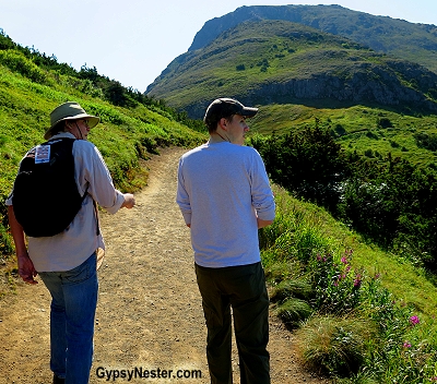
Between huffs and puffs, we laughed and caught up on the stories we hadn’t relayed over a long distance phone calls. Every now and then, we paused as The Boy pointed out his favorite views.
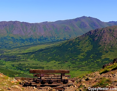
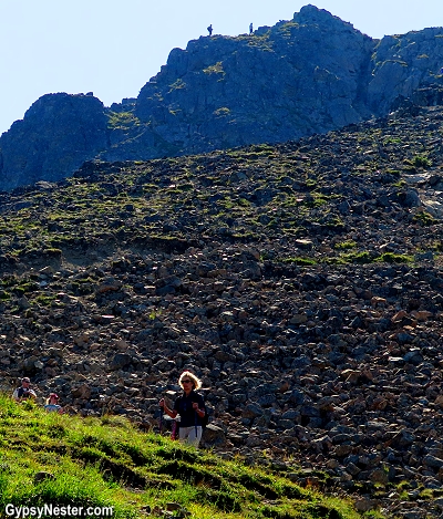
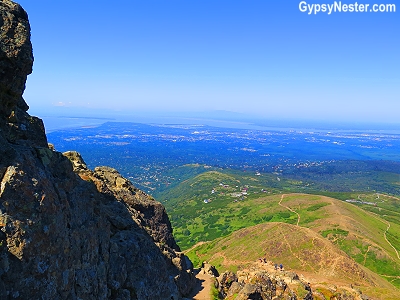
The Boy had made it to the summit of Flat Top Mountain once before with friends (his age) and was going on and on about how great the view was from the top.
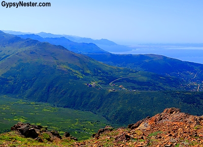
It was already getting pretty darned good. As we gained altitude, Anchorage and the mudflats of Cook Inlet spread out before us and we could see the majestic peaks of the Alaska Range and Denali off in the distance.
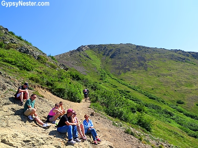
About halfway up, I noticed that some of the older folks, along with parents with very young in tow, found good reasons to turn back.
For many, a scenic platform marked a reasonable stopping point. Others found a stretch of trail was too steep or they simply lacked the ridiculous competitiveness that doesn’t take into consideration one’s limitations.
The platforms and steep trail stretches could have given me an easy way out as well.
I was already taking too many breathers-disguised-as-photo-stops – and I wasn’t fooling anyone.
But David and I are highly competitive. Not in a let’s-do-something-incredibly-lofty kind of way, like winning a gold medal for our country. Nor are we particularly competitive with other people (unless trivia games count).
It’s like we’re perpetually stuck in fifth grade. One of us is going to get our tongue frozen to a playground flagpole one day, just watch. All it would take is a triple-dog dare.
So the steepness wasn’t going to stop me, because there was no way I was going to listen to David nana nana boo boo me when he made it to the top and I didn’t.
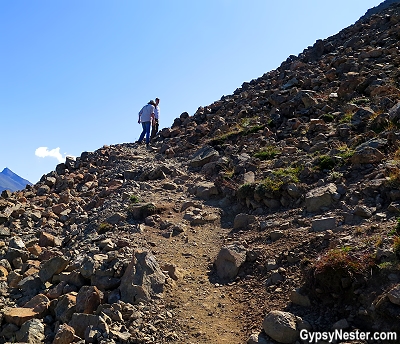
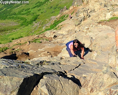
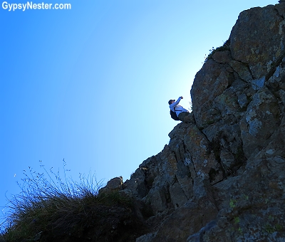
My first real challenge came when the gravel started making an appearance.
Gravel, steep incline, and an of-a-certain-age novice climber is not a good combo – I kept losing my footing and my bravado was quick to follow.
David was unfazed, he used to climb mountains when he lived in Colorado as a teen, and he seemed right at home.
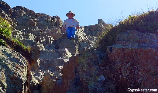
It also didn’t faze him when the terrain turned into a rock climbing wall.
Me, who had never climbed a rock wall — real or at a kid’s birthday party — was shocked as hell.
Surely The Boy knew that this was coming, and that I was going to freak out.
Or maybe he found it so easy for his twenty-five-year old self to scramble up, that the thought didn’t cross his mind that it would be a daunting challenge for someone (gulp) over twice his age.
Right before things went terribly awry.
I stood, knees knocking, at the base of a straight-up, one-hundred-foot wall and resigned.
“I can’t do this.”
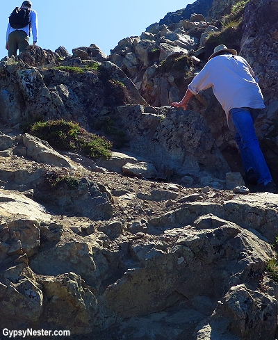
“Sure you can, Mom. We’re almost to the top and it’s so great up there. C’mon, I’ll show you exactly where to put your feet.”
There wasn’t a clear path or trail and climbers were back-tracking areas they had already attempted, asking each other for advice about the best way up.
David chose a route and headed up, The Boy holding back to give me guidance.
I made it three quarters of the way before I kicked a piece of loose rock and heard it clatter down the mountain.
It clattered and clattered and clattered. For a long, long time.
Hanging on the side of a sheer wall in a very unnatural position — harkening a vertical, pigeon-toed murder-scene-chalk-outline drawing — I squeaked out a feeble call for help.
There was nothing The Boy or David could do to move me. I hung there with my hair whipping around my head and my eyes shut tight until my heart stopped racing.
David pointed out a semi-circle of ledge just wide enough for my butt and I made getting there my life’s work.
Please God, just let me sit for a while and figure this out.
Reaching the ledge, I sat down and commenced shaking. I sent the guys on, telling them I’d scoot down on my rear end when I felt safe enough to do so.
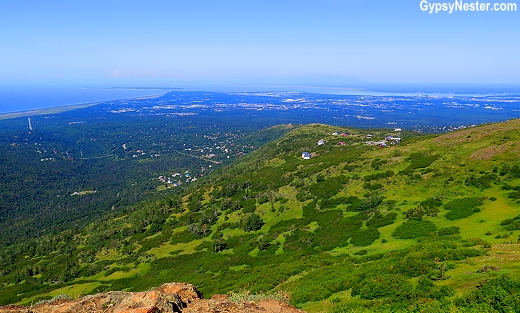
The incredible view from my fear ledge.
After much hemming and hawing, they went on. I sat stock still until I found myself enjoying the incredible view again.
Then I upside-down crab walked to the last place I felt safe. The guys were already there.
“Mom, you were twenty feet from the top – we found an easier way up for you.”
“Honey, c’mon. It’s fantastic up there. We came down to get you, we want you to see it.”
They hadn’t been reveling in their own achievements as they deserved, they were looking for a way for me to join them.
How do I say no? Did I want to say no? No. I wanted to do this.
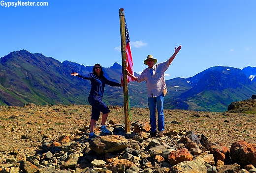
I followed The Boy up, put my feet where he put his feet. He lovingly coached me to the top. Through my panicked tears, I felt a mother/son bond I’d never felt before. My son, the man, was taking care of me.
And the reward at the top was phenomenal. There was a flag and everything!
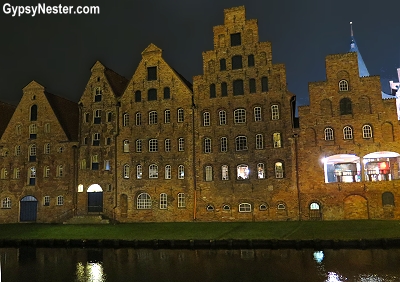
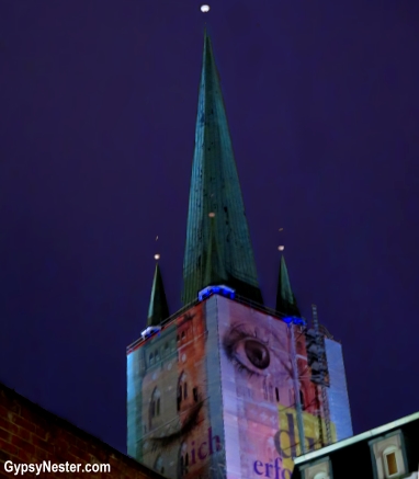
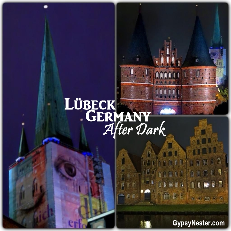
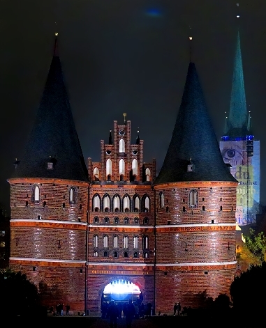
Visiting Lübeck, Germany was one of those lucky coincidences that sometimes happen when traveling.
We chose it as a stopover on our Eurail Pass expedition across northern Europe mostly for its location.
But inside the famous Holsten Gate, we discovered a wonderful, history-filled city that lights up when night falls… CONTINUE READING >>
Visiting Lübeck, Germany was one of those lucky coincidences that sometimes happen when traveling.
We chose it as a stopover on our wintertime (therefore much of it after dark!) Eurail Pass expedition across northern Europe mostly for its location.
But inside the famous Holsten Gate, we discovered a wonderful, history-filled city that lights up when night falls.
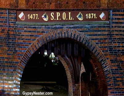
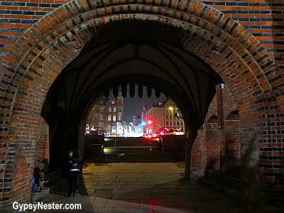
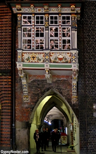
Walking under the arch into the ancient walled city, we noticed that the side of the gate facing the city is dated 1477, which is the year it was made.
Another date, 1871, commemorates the year that the town voted to save the gate instead of tearing it down with the rest of the walls.
The story we heard is that the restoration resolution passed by only one vote, leaving the gate as one of the last remnants of the walls that once protected the city.
The refurbished gate, with its distinctive towers, went on to become the symbol of the city, and actually became quite famous, appearing on several stamps and the old fifty Deutsche Mark bills.
Now, the German version of the two euro coin proudly displays the gate.
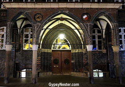
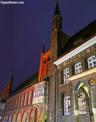
After walking a few blocks into the city, we came to the pedestrian mall in the center of town.
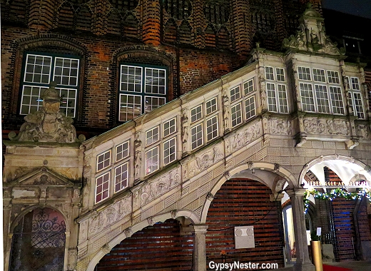
Hanging a left took us to the Lübecker Rathaus, a pleasant surprise if there ever was one.
This is the town hall by which all other town halls should be judged.
Construction began in the year 1230, and was completed in 1308.
Over time, additions were added to the hall to accommodate the Supreme Court for the region and a Danzelhusand (dancehall) for community events.
LOVE this staircase.
Before too long, the structure covered an entire city block.
There are a number of intriguing details about the building that popped out on closer inspection.
The glazed bricks, vaulted ceilings inside, and figures decorating the little balcony were all eye catching, but for us the different-sized doors for exiting the courthouse were most fascinating.
It turns out that the taller doorway was for those of the accused found to be innocent, while the shorter was reserved for the guilty.
The incredible building served as a meeting place for the Hanseatic League, a powerful alliance of Baltic and North Sea traders that lasted for over five centuries.
The presence of the league gave Lübeck a stature well beyond its size, and it became the de facto capital for the area.
By the 14th century, Lübeck became known as Queen of the Hanseatic League.
In fact, although it is part of Germany now, for most of its existence it was an independent city-state, the Free and Hanseatic City of Lübeck.
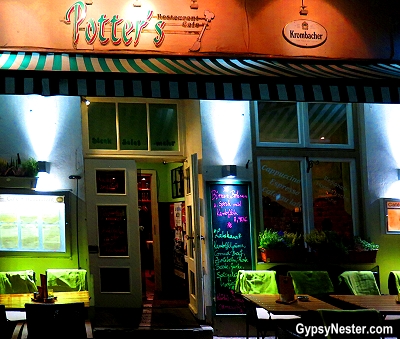
As compelling as this jaunt through history was, we were ready to eat.
On the recommendation of our hotel desk clerk we popped in to Potter’s, known for serving traditional regional fare.
The little cafe sits on the banks of the Trave River, which splits to form a natural moat around the old city center.
View across the invading hoard-evading moat.
This provided us with a feeling of safe haven while having our dinner without the threat of any invading hoards.
The specials on the menu were completely unknown to us – which is always right up our alley.
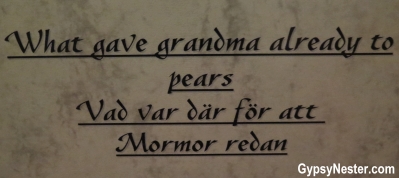
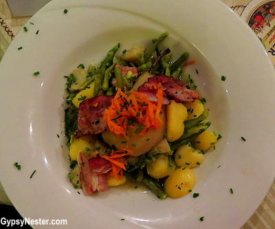
The first, päron, bönor och bacon, was well described as pears, beans and bacon with potatoes, but also included the quote:
“vad var där för att Mormor redan,” which the menu told us meant:
“What gave grandma already to pears.”
Our old friend Google also informed us that this was not in German, but Swedish.
We asked our server for an explanation and got no farther in our understanding, but ordered it anyway.
We figured if it’s good enough for grandma…
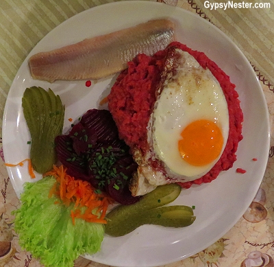
The other special, Labskaus, seemed clear enough; mashed potatoes, corned beef, onions, beets, cucumber, egg, and a herring fillet, but when we asked about it the answer took an unlikely turn.
Our server explained that it tastes good, but looks terrible. Oh, and yes, we should definitely try it.
Her exact words were, “It looks like scheiße.”
Now we don’t claim to sprechen sie Deutsch, but we do know just enough German to know what that meant.
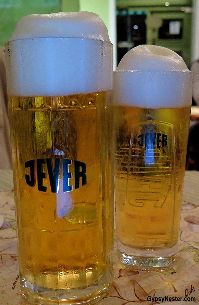
We ordered it anyway… and beer, just in case we needed to wash it down quickly.
When the dishes arrived we found that grandma, and our server, didn’t steer us wrong.
The pears, cooked with bacon and green beans, were certainly different and new, but really worked extremely well together.
On the other hand, the Labskaus fit the less than appealing description given to a T.
Without a doubt, the meat mashed into the potatoes gave it a distinctively less-than-appetizing — dare we said it scheiße look — but it tasted good, sort of like corned beef hash with a fried egg on top.
We couldn’t really discern what the herring was doing alongside, nor the beets and gherkins.
It was very much like there were two completely separate dishes served on the same plate.
However, we were happy to add another couple of new local favorites to our epicurean adventure list, and we certainly weren’t leaving hungry.
In fact, we were fairly certain that we might never be hungry again.
That notion was short-lived though, we put it thoroughly to the test as soon as we discovered a genuine Swedish smorgasbord in Stockholm a few days later.
YOUR TURN: Don’t you love those unexpected stops while traveling? Aren’t you glad that they didn’t tear that beautiful city gate down? How ’bout that food?
Revel in the amazing scenery and wonderful wildlife of Alaska’s Seward Highway with your GypsyNesters!
Gaze at glaciers, see weird animals (remember weird=good!), ride up a huge mountain on a wire, sample real-deal sourdough bread and learn how not to lose a shoe in a mudflat… CONTINUE READING >>
We are proud to be Viator Ambassadors – big thanks to Viator for providing this wondrous adventure! As always, all opinions are our own.
Ever since The Boy moved up to Alaska to pursue his flying career we have been planning our own adventure to The Last Frontier.
There were a few details to work through though; there was no way we were going during the never-ending dark and cold of the winter months, and the fact that it is a long, long way up there.
So for over a year we had not made the trek north to Alaska but finally, with Johnny Horton’s classic ballad ringing in our ears for the entire ten hours of flight time, we reached the 49th state.
This was especially fitting, as it was also Veronica’s 49th state to check off her bucket list.
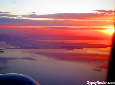
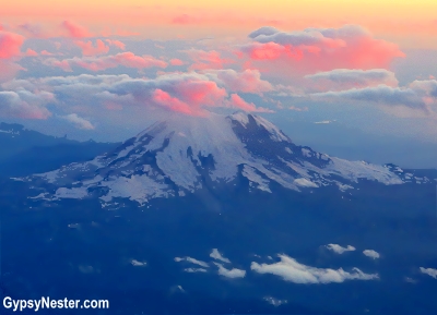
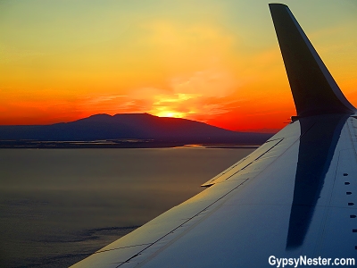
We really shouldn’t complain; the final five hours from Salt Lake City to Anchorage had some of the best views we have ever witnessed from an airplane window.
The sun was just setting over the Great Salt Lake as we took off and, due to the time of year, we chased the sunset as we jetted north and west.
This meant that we saw Mount Rainier and The Cascades bathed in colors we’d never experienced, as well as Vancouver Island, and the Inside Passage.
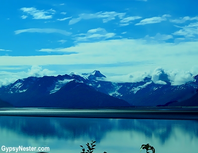
In fact, the daylight was increasing as we went toward the pole and by the time we flew over the massive glaciers in the Chugach Mountains on Alaska’s southern coast it was broad daylight.
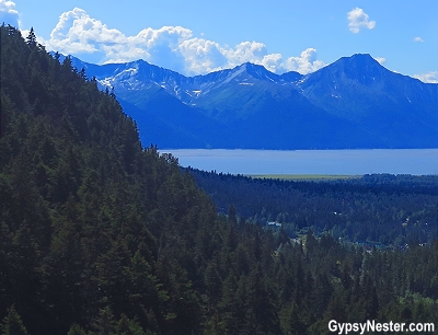
We knew our visit would include incredible mountain scenery, glaciers, and our best chance yet for Veronica to finally see a moose (she didn’t believe in them), but we hardly expected two out of three before we even landed.
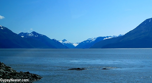
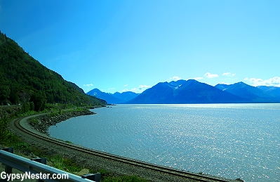
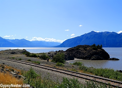
We met up with the tour in Anchorage and headed south on the Seward Highway along the Turnagain Arm of Cook Inlet.
The very same Chugach Mountains we had flown over now rose up from the water, and it was easy to see why the road has been designated a National Scenic Byway.
Captain James Cook sailed here in 1778 while searching for the Northwest Passage, but the Turnagain Arm that we were following was named by none other than William Bligh of HMS Bounty fame.
When Cook sent him to scout out the inlet he soon found that it was not a passage and had to turn around again.
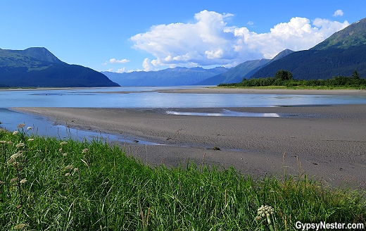
The arm is also famous for having some of the biggest tidal changes in the world, up to forty feet at times, and while we drove along our guide, Chloe, noticed that the water beginning to recede.
We stopped at Beluga Point for a look at the mudflats that are left behind when the tide goes out.
The mud can act like quicksand and some people have been trapped in it, so Chloe impressed upon us that — no matter how cool it looked — we should avoid walking out on it.
At the very least, she explained, we’d have a shoe sucked off our foot for our misdeed. We certainly didn’t want to spend the remainder of what looked like a splendid day ahead of us muddy and one-shoed.
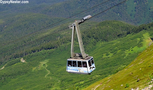
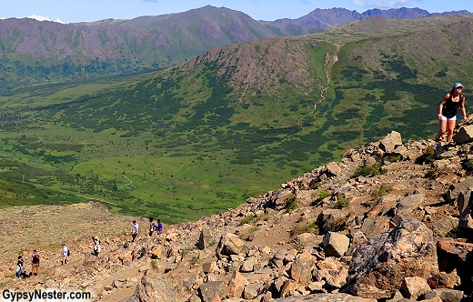
Back in the bus, we drove to the small village of Girdwood for a chance to stand on — and look down from — the peaks we had been passing all morning.
The tiny town is home to Alaska’s largest ski resort, Alyeska, but in the summer becomes an alpine playground for climbers, cyclists, and parasail jumpers.
We were more than content to confine our adventure to riding up the mountain on the Alyeska Aerial Tram.
The tram was built as a ski lift, climbing twenty-three-hundred feet above the valley below, but this time of year it carries sightseers like us, as well as daredevils with their bicycles and parachutes who either jump or free-wheel back down again.
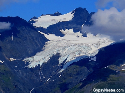
We hiked further up the mountain to get a closer view of the glaciers.
From the top we could see several hanging glaciers on the nearby peaks, and had a bird’s eye view of the cyclists and parachutists.
It’s not every day that we get to watch skydivers from above.
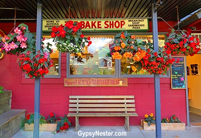
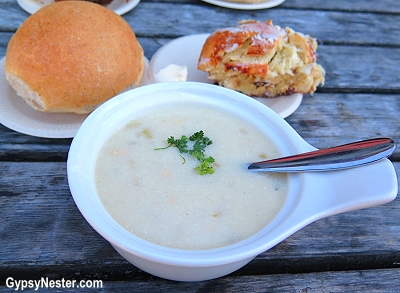
Back down at the base of the slopes we settled in at outside tables to bask in the summer sunshine and enjoy lunch at The Bake Shop.
This gave us a chance to break (Alyesca sourdough) bread and converse with the members of our group who had come from all over the world, as far away as Australia and Japan.
We even had a Russian with us, perhaps returning to visit his country’s former territory.
Fortified with bottomless gourmet soups and fresh baked breads, we were rarin’ to go onward and visit the animals at the Alaska Wildlife Conservation Center.
The Center’s primary function is as a refuge for orphaned or injured wildlife until they can be returned to the wild.
They also provide temporary accommodation for species that have become rare in Alaska and are being reintroduced into their native habitat, such as elk, wood bison, and musk ox.
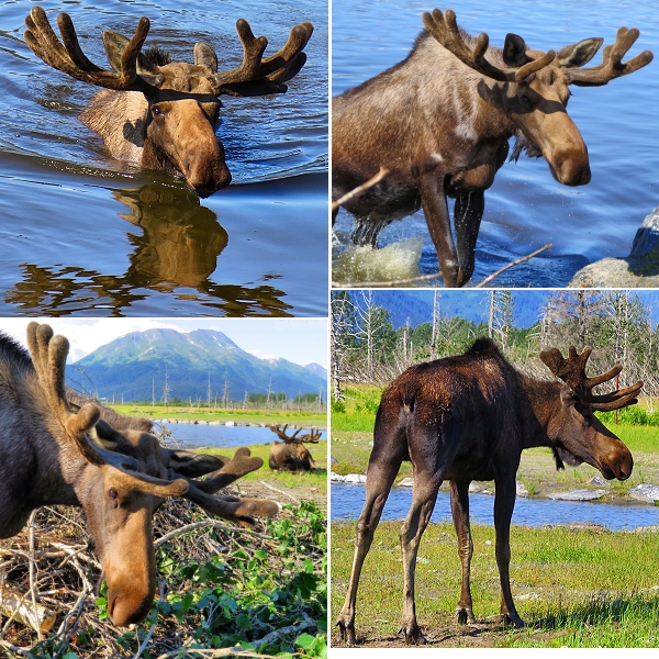
We had also heard the rumor that they had some real, live moose in attendance.
Hopefully we could not only see them, but get close enough to convince Veronica that they were not actually two men in a moose suit.
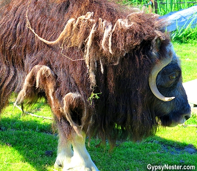
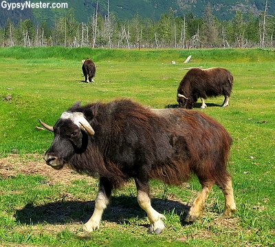
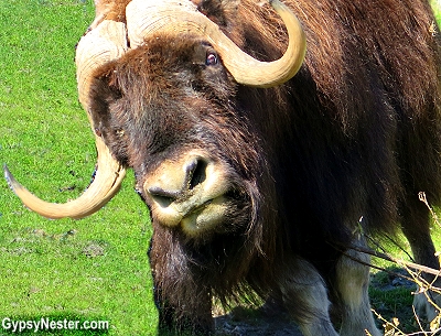
When we arrived at the Center, the first animals we saw were some shaggy brown and black critters that looked like Cousin Itt with four legs.
Like many visitors to Alaska, this was our first time seeing musk ox and we didn’t know what to expect.
We were surprised to find them considerably smaller than we imagined.
From the name we envisioned massive oxen roaming as giants of the tundra, but these guys are actually members of the goat family and their stature reflected that.
One hundred years ago there were none left in Alaska, due to over hunting, but now, since being reestablished, their numbers are increasing in the wild.
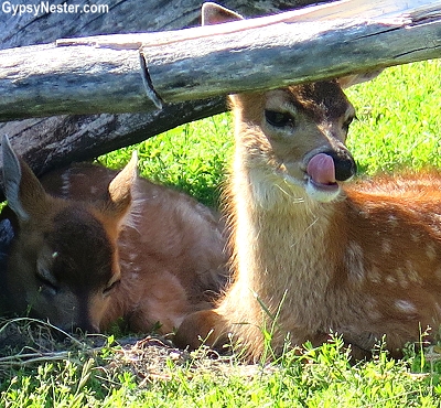
Without a doubt the cutest critters award went to three tiny Sitka black-tailed deer.
These little orphaned fawns were only a month old and still sporting their baby spots.
Their mother was hit by a car, so they will be raised and either remain safely at the Center or be released back into the wild, depending on their progress.
This guy seems pretty happy about his rescue!
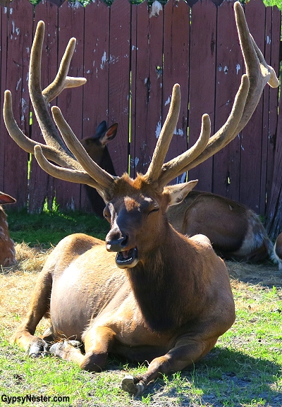
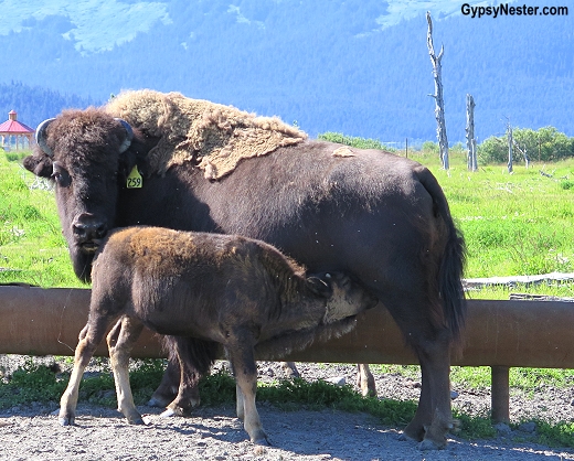
The Center is also active in breeding programs for several species, and the next two pastures were home to elk and wood bison.
Both have been successfully bred and herds have been reestablished in the wild thanks to programs like the Alaska Wildlife Conservation Center.
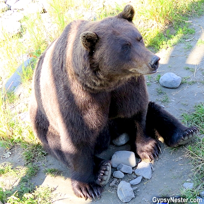
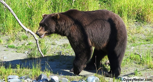
Next we stopped briefly to see the bears.
The Center keeps several that were brought in as orphaned cubs, as well as one huge grizzly, Hugo, that arrived wounded and near death fifteen years ago.
After living with assistance, none of these bears have the proper skills to be on their own, so Hugo and his buddies they have a permanent home now.
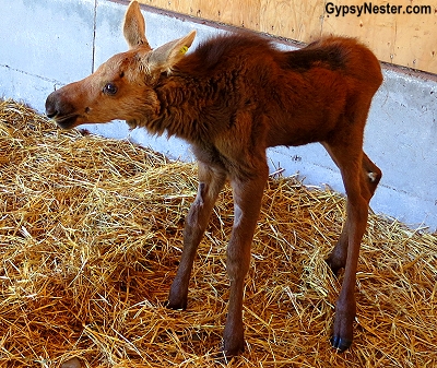
We had covered nearly the entire grounds without any sign of a moose and we were beginning to wonder if some more moose-cuses were about to be thrown out at us.
But then we noticed a sign on a barn that claimed there was a baby moose inside.
Deep down, David knew that a calf was not really going to do the trick when it came to convincing Veronica about moose.
Just as he’d thought, after close inspection she declared that it was probably just an ugly cow; a cute, ugly cow.
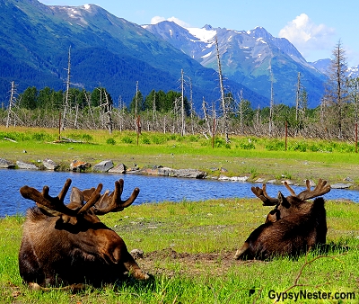
We needed to see a big one, antlers and all, up close.
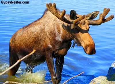
Luck was on our side, because just as we exited the barn we spotted two big fellahs lounging in the field by a pond.
The Wildlife Center took in Nelson and Teddy after they were orphaned and they have become one of the main attractions.
We walked over to the fence to say howdy, but they were not impressed with our presence.
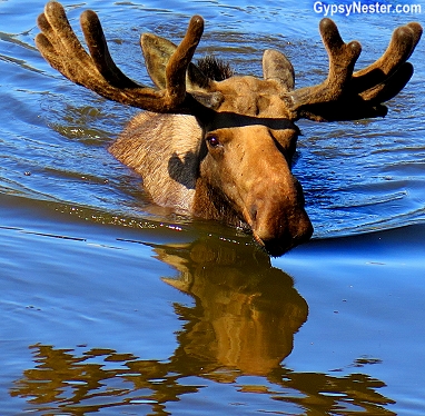
Then one (we are certainly not skilled enough in moose identification to know which) decided to go for a swim.
Wait. Moose can swim?!
After climbing out of the water, he walked right up to us and stood only a few feet away for quite some time, casually munching on some tree limbs that had been left there.
We easily could have reached out and touched him, but that didn’t seem like a very good idea.
So that was that, no way to deny the existence of moose anymore.
We got the chance to see a bull as up close as any human could ever hope to.
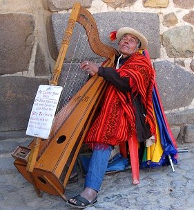
Anyone making their way to Machu Picchu must first traverse The Sacred Valley of the Incas (Valle Sagrado de los Incas), and we were no exception.
But this was no tedious trek, it was a fascinating adventure in its own right.
Join us as we visit the people, the food, the culture and the spectacular natural and ancient beauty of… CONTINUE READING >>
Anyone making their way to Machu Picchu must first traverse The Sacred Valley of the Incas (Valle Sagrado de los Incas), and we were no exception. But this was no tedious trek, it was a fascinating adventure in its own right.
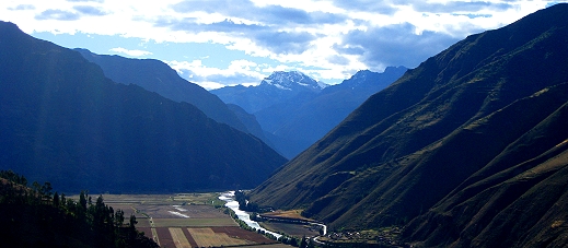
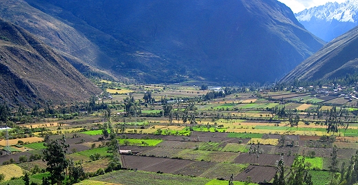
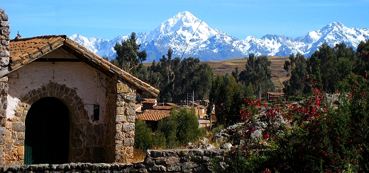
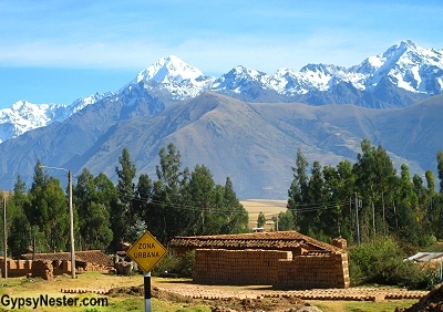
The valley was formed by the Urubamba River, which is part of the headwaters of the Amazon, and has a wealth of both natural and agricultural resources. This, and the proximity to the Inca capital Cusco, made the region the heart of The Inca Empire.
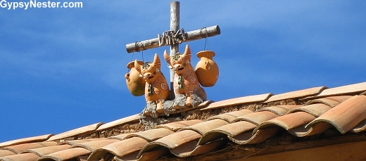
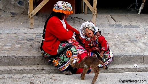
On the roofs of most of the houses in the Sacred Valley are small shrines that include a cross indicating the family is Christian, ceramic bulls for strength and fertility, a cask of corn beer to tie them to their ancestors, and a vial of holy water to sanctify the house. (This shrine was in the town of Chincheros)
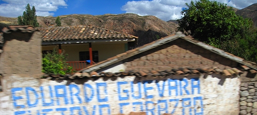
Many homes sport advertising on the outer walls facing the road. Signs for politicians seem to be most prevalent.
The people of The Sacred Valley prefer to get around on foot. However, buses do run up and down the valley, as well as trains.
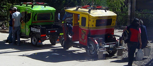
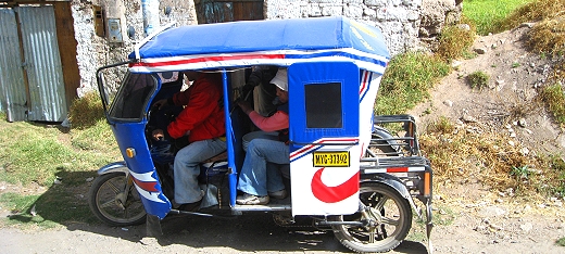
Taxis – colorful, tricked out, modified motorcycles – ferry visitors and residents alike around the towns.
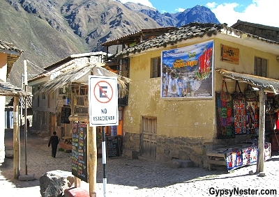
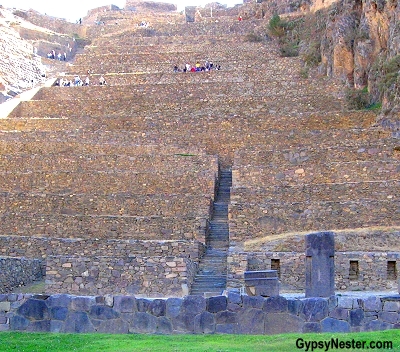
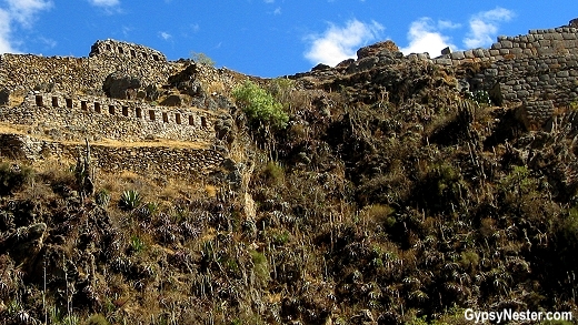
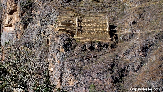
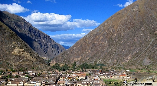
As we followed the river toward our ultimate goal we came to Ollantaytambo, a town that sits at the foot of enormous ruins that share the same name.
The town dates back to the late 15th century, contemporary with the ruins, and has some of the oldest continuously occupied dwellings in South America.
It also serves as the gateway to Machu Picchu, since this is the starting point for the famous Inca Trail (for backpackers) and the narrow gauge railway (for the oh-my-aching-back crowd) that are the only ways to reach the legendary Lost City.
As remarkable as the village of may be, the archaeological site is the main attraction.
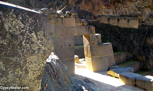
We entered the site, gawking up at the stonework that covers the entire side of a mountain, and our guide, Eddy, gave us some background.
Originally the royal estate of Emperor Pachacutin, it became a bustling agricultural center, and then during the Spanish conquest, served as a fortress for Manco Inca Yupanqui while leading the Inca resistance.
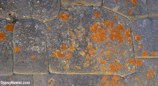
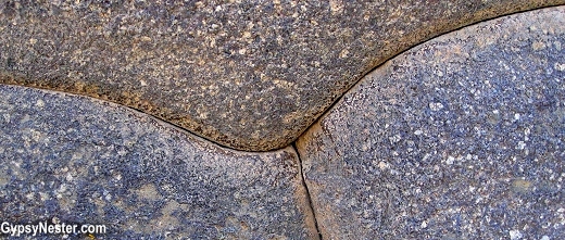
He went on to point out the many stones left sitting where ever they happened to be at the time that work was abandoned, showing how this site was still unfinished when the Spanish arrived in the 1500s.
The freestanding stones gave us a close up look at some of the amazing stone cutting and shaping involved in the construction.
Eddy also took this opportunity to explain something that he says has been misunderstood for centuries. The name of the people who lived in this area when the Spanish arrived was not the Incas, but the Quechua, pronounced Ke-chu-wa.
This name is now routinely used only for the language the people spoke, and many still speak, but that is not totally correct, it also identifies a people. Inca does not.
It was only the name for the ruler, as in the Inca ruled over the Quechua.
In order to diminish these rulers in the eyes of the people and take their place, the Spanish began to call everyone and everything Inca, taking away its royal standing.
“You’re Inca, you’re Inca, that building is Inca, it’s all Inca.”
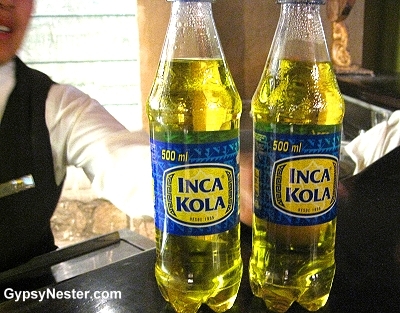
It was a strategy that worked so well that the original meaning has been all but lost. In fact even a popular yellow, overly sweet soda has usurped the once imperial title.
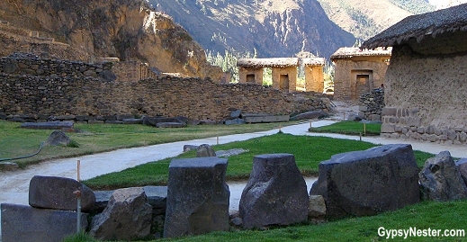
The bulk of the Ollantaytambo archaeological site is covered by huge stone terracing that was specially designed to transform the impossibly steep hillside into usable crop land. This not only provided level ground for farming, but also prevented landslides and flooding in times of heavy rains.
Alongside these stair-stepped growing areas are granaries built to store up to five years supply of food as preparation in case of drought, blights or freezes.
This was just one of the methods used to guard against a poor harvest.
Crops were also planted at different altitudes to insure proper growing conditions, and many varieties of each crop were developed. For example, hundreds of different types of potatoes would be sown. Each cultivated for certain characteristics such as resistance to insects, cold, heat or dry conditions.
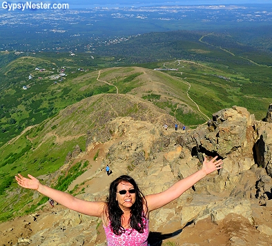
This was all fascinating stuff, but our natural inclination was to climb, so we did, up over 9000 feet. It’s a bit hard to breath up there, but we huffed and puffed, and I-think-I-can, I-think-I-canned our way to the top.
Above all of the agricultural structures is a temple. This was the part still being worked on when Ollantaytambo was abandoned, so it is not overly impressive, but some of the massive stones are, and the view certainly is.
From the top we could see for miles in every direction and make out the path across the valley to the quarry where the stones were originally cut.
From there the giant rocks were hauled down that mountain, over the river, and back up this mountain, all without the use of wheels. One of the many mysteries that surround the building abilities of the Quechua people when ruled by the Inca is the lack of the wheel.
Eddy offered the theory that the round shape represented the sun and moon and therefore was sacred, so it could not be used for such mundane tasks as moving rocks. Possibly, but no one knows for certain why they didn’t use wheels.
Another of the mysteries of Ollantaytambo is exactly how the stones were cut, because no metal hard enough to cut granite was available at that time. Since the Quechua language was not written, and the Spanish destroyed most evidence of methods used in construction, we may never know the answers.
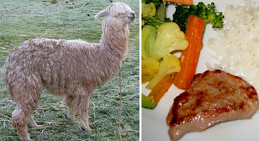
After our climb we had worked up a pretty good appetite. Dinner at Posada del Inca, our headquarters and hotel during our stay in the Sacred Valley, gave us a chance to try some alpaca.
Our first real culinary adventure on the trip, alpaca is basically a smaller version of the llama.
Although they look somewhat like sheep, alpaca are actually a relative of the camel.
Can’t say we ever had a hankering to try any roasted dromedary, but the alpaca looked quite good. Tasted like chicken, just kidding, more like veal but with a texture a bit like liver.
The next morning promised yet another blue-skied beautiful day. As much as we had seen on our visit to The Sacred Valley, this was still a stepping stone for us.
A warm up for the main event of Machu Picchu. And since our days of hiking four days over rough terrain are probably behind us, The Inca Trail was out.
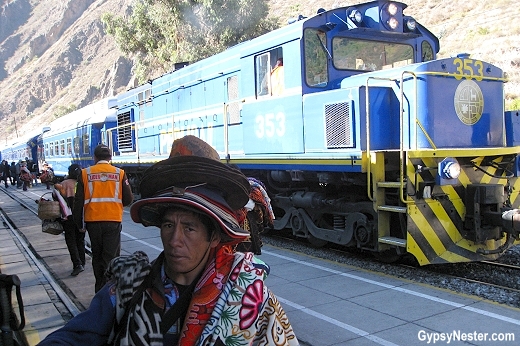
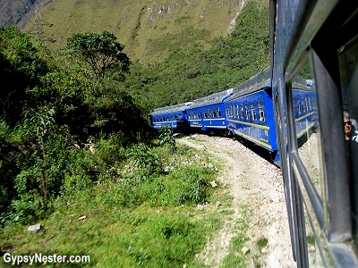
We needed to make our way to the train station.
PeruRail operates several trains a day to the town of Aguas Calientes along track originally laid in 1928.
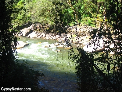
The town sits in the valley below Machu Picchu and the narrow gauge ride down the Urubamba River, through spectacular Andes mountain scenery, took us on the second highest railroad in the world, after the Qinghai–Tibet Railway.
Watch: The train to Machu Picchu is a trip! There is even entertainment!
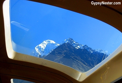
About 15 minutes out of Ollantaytambo, we spotted an enormous snow covered peak, only to find that it was named Veronica.
How about that? We just got here and they’re already naming mountains after us.
And not just any old mountain either, Veronica sports a summit over three-and-a-half miles high.
As we rode along we saw more of the agricultural terraces on the valley slopes, many which are still in use.
Descending downstream, the environment changed as we moved from alpine meadows into tropical rainforest.
By the time we reached the end of the line every inch of land was covered by thick jungle.
Deseret News intrigued us with some interesting Boomer stats and asked us to weigh in with our thoughts and experience!
“With a son who is a pilot and is able to fly and see them often, as well as two daughters who can both be visited by traveling to the same city, the family is reunited often.
‘I’m fairly certain we see our kids more traveling a lot more than if we were in one place’”
Deseret News intrigued us with some interesting Boomer stats and asked us to weigh in with our thoughts and experience!
“With a son who is a pilot and is able to fly and see them often, as well as two daughters who can both be visited in two of the world’s greatest cities, the family is reunited often.
‘I’m fairly certain we see our kids as often traveling than if we were in one place’”


 Before too long, the structure covered an entire city block.