

The idea of voluntourism is just what the newly invented word implies, tourism that incorporates volunteer work.
This concept is fast becoming popular among travelers, and we were thrilled at the opportunity to join with Discover Corps, an organization that works closely with highly vetted, local community leaders.
Of course there are many other opportunities to volunteer available, such as this one that our friend Agness at ETramping.com enjoyed in Guinea – West Africa.
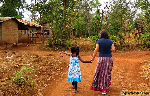
We traveled to Tanzania to experience the phenomenon firsthand.

As tourists, we would see and climb (half way) Kilimanjaro, spend a day with the Maasai people, learn how to make batik, watch and join in dances, go on safari, and immerse ourselves in the day to day life of the Chagga who inhabit the region.
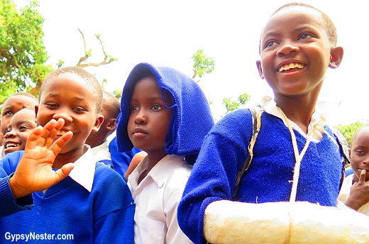
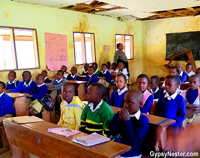
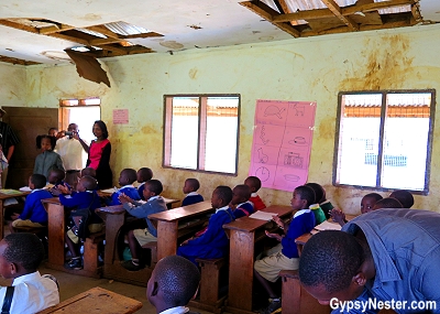
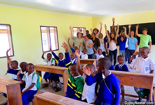
The volunteer portion of our trip was focused on the Lunguo Primary School near the village of Rau.
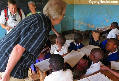
We spent mornings teaching English and afternoons refurbishing a classroom.
Each of these tasks offered unexpected rewards and challenges and resulted in emotions and memories that will last our lifetimes.
Luckily, Discover Corps works with a local leader, the incredible Mama Simba, who was on hand to help us with the language barrier, provide us with lesson plans, and instruct us on the local customs we needed to know to be effective in the classroom.
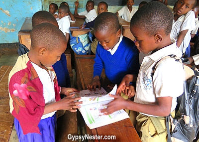
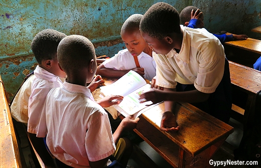
On the teaching front, we encountered several obstacles the school has been unable to overcome.
There was a woeful lack of supplies and workbooks at the school.
In our class there was only one ragged book for every six students, and many of our students shared pens and paper.
Our temporary solution was to integrate visual aids and edutainment into our teaching methods.
Our fellow teammate, Jeff, took charge by enlisting help in finding the items described in the workbook while Veronica wrote out the sentences from our lesson plan on the blackboard.
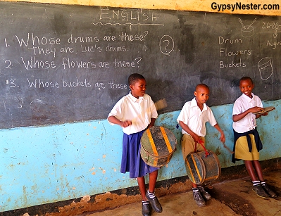
In no time Mama Simba found drums, Jeff’s daughter Annie picked flowers, and a couple of kids produced a pair of buckets (seemingly out of nowhere!).
We then replaced the fictitious characters from the textbooks with our pupils’ names and suddenly the kids really seemed to enjoy the task of repeating the questions and answers such as “Whose drums are these?” and “These are Luc’s buckets.”
The children took new interest in writing the phrases in their notebooks, most with remarkable penmanship.
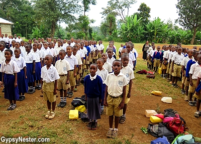
As we began our second day of teaching the children greeted us with a song.
After blazing through their lessons of the day, sixty pairs of third-grade eyes looked to us for guidance.
It soon became obvious that our attempt to skip ahead to the lesson planned for the following day wasn’t going to work – another few rounds of writing questions and answers on the chalkboard and in their notebooks wasn’t going inspiring any of our little guys.
They were getting a tad restless.
Teachers are Hilarious!

Then it hit us, let’s sing!
David is an ex-music teacher, so incorporating music into our lesson easily comes to him.
Learning animal names was the day’s agenda, so a spirited rendition of Old MacDonald’s Farm was just the ticket to burn off some excess energy.
After a bit of a pronunciation snafu (we wrote “e i e i o” on the board, rather than the common international vocalization of “i e i e o”), acting out the animal sounds was a big hit, especially when Jeff led a procession of chickens around our classroom.
Clucking and flapping ruled the day!
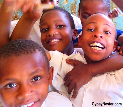
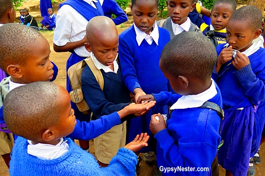
After a few days the kids were beginning to know us a bit better, and the natural leaders (and class clowns) stepped up in their roles.
Their examples seemed to help the more timid students come out of their shells as well, so all of the class was now participating.
Even if our teaching methods were somewhat unconventional for Tanzania, we hoped to impress memories that our kids would retain, and recall the English names of everyday items such as musical instruments, farm animals, and body parts (Head, Shoulders, Knees and Toes was another greatest hit in our repertoire).
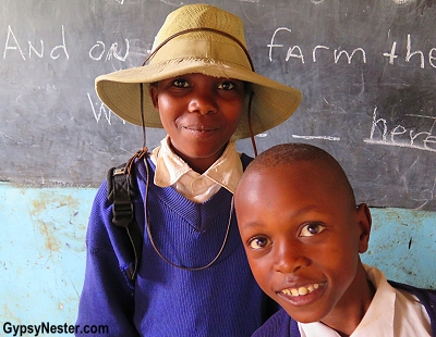
As the days went by and we grew closer to the teacher in charge of our classroom, we felt comfortable asking if we could purchase additional workbooks for the kids.
When she gave the go-ahead, we found a store that sold school supplies and bought all twenty copies that they had in stock.
The additional books, while not enough to bring the total up to where each pupil had their own, helped immensely. Little things, like handing out pencils, pens, and paper that they kids could call their own, also garnered great excitement.
Perhaps we learned the bigger lesson that day: appreciate the simple things.

The little guys absolutely lit up when receiving the simplest gifts.
A cute little sticker for a job well done, brought smiles that would rival any child’s Christmas morning grin (and often ended up on a forehead!).
Their happiness was completely contagious and without a doubt we received as much from them as they did from us in our short stint as teachers.
Getting to Know You
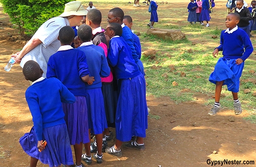
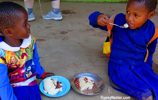
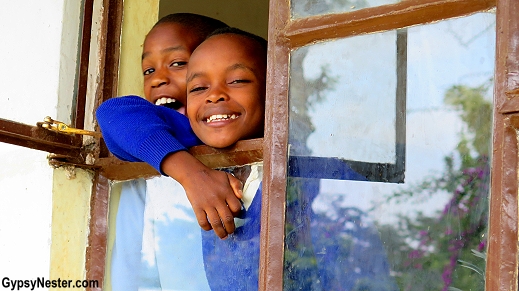
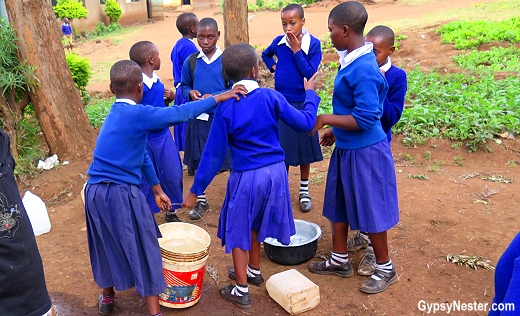
Our English lessons were the last class before lunch and we had time to socialize with our students during recess, as well.
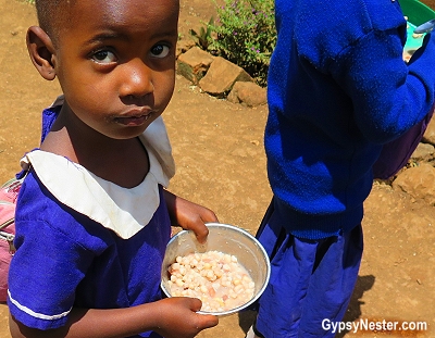
Students bring bowls from home and carry them to the school kitchen.
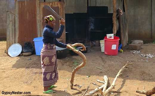
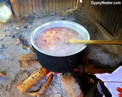
One of the many challenges that Longuo Primary School faces is no electricity, so the kitchen is outdoors and the food is cooked over an open fire.
Provisions have been donated for a year by a good samaritan so the children can have a good meal.
For some, Mama Simba told us, it is the only meal they get all day.
We were moved by a little one who had a tiny ball of rice.
Instead of eating it by herself, she shared with many other children.
Mama Simba explained to us the concept of chakula ni mavi – food is nothing; remember what is important.
Food is always shared and given freely.
The noon meal almost included ugali, a staple of the Tanzanian diet that is a thick corn meal porridge.
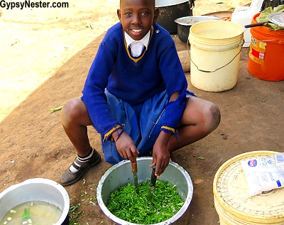
Other ingredients can be added, often provided from the garden at the school.
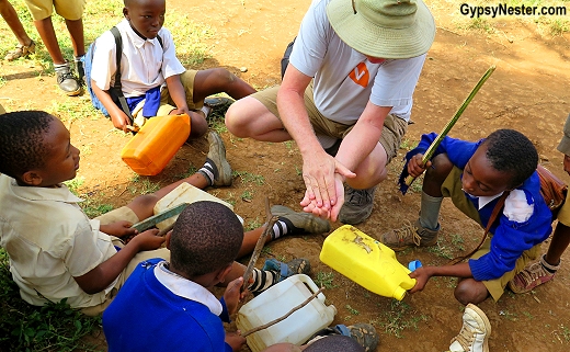
The children tended to the plants each morning, watering from jugs that they bring from home.
After lunch, we had a bit of time to play soccer (we got owned), bang makeshift drums (David’s favorite pastime), or simply sit under the trees and enjoy each other’s company.
Our rockstars!
WATCH: A day in the life with our wonderful students!
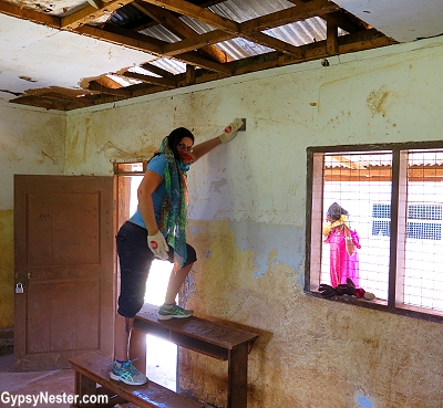
Donning our Construction Helmets
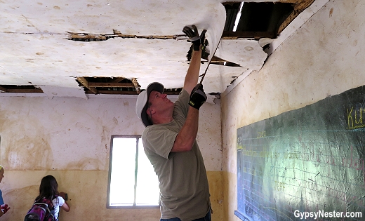
Our afternoons were filled with reconstruction.
Changing from our more formal teaching clothes into our work duds, we got ready to get dig into some serious renovations.
The original project was to be a simple painting job of a classroom, but as we surveyed the situation it quickly became clear that we wanted to go beyond that on our own.
We decided that painting would be nearly futile unless we repaired the leaking roof and replaced the rotting ceiling panels.
But funds for this were not available in either the Discover Corps or the school’s budgets.
Our new buddy Jeff stepped up big time though, and took the lead. His experience as a remodeler kicked in and next thing we knew we were pricing materials at a hardware store a few miles away in Moshi.
Looked like the project could be tackled for a reasonable price and everyone in our group excitedly threw in donations to cover the costs.
The distressing condition of our project classroom was unfortunately not an outlier at Lunguo. The school had no electricity or running water, and we don’t even want to get into the toilet situation – we’ll let it stand as heartbreaking.
But, we had seen what the prior Discover Corps teams had achieved in other classrooms, and were heartened by the results.
With our assessments made, the first item on the agenda would be the easiest, and cleanest, task that we were likely to encounter throughout the job, take the “before” pictures.
We could hardly wait to see the “after.”
Armed with fresh supplies, our band of volunteers divided into groups and dug into our initial tasks.
While some of us were cleaning and sanding the walls to prepare for a new coat of paint, others were painting the new ceiling tiles before installation, and the rest of us were tackling tearing out the old ceiling.
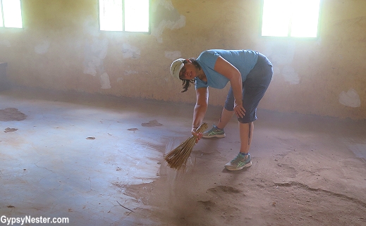
The old saying, it’s a dirty job but someone’s got to do it, certainly described our efforts and, by the end of day one, we could have been called the dirty dozen.
Over the next few days, our Discover Corps team stepped into the role of construction crew with gusto.
With the old ceiling removed we could seal the holes in the tin roof and avoid any future water damage to our new panels.
By the end of the first week we felt like we had things pretty well in hand and would be ready to paint the room and install the panels when we returned the following Monday. But there were unforeseen roadblocks ahead.
We had overlooked the fact that the beams that held the panels in place were far from straight, so aligning the ceiling was almost impossible. David and Jeff had expected the installation to be relatively simple.
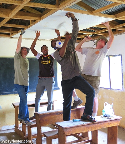
Wrong! That same crooked wood was also incredibly hard, making driving nails quite a chore, especially from underneath… while standing on rickety desks.
After an entire afternoon we only had handful in place. Mama Simba was correct when she had suggested that perhaps we had bitten off more that we could chew.
The school’s headmaster suggested a carpenter friend to come help and we gladly accepted.
By the end of the next day, we had nicknamed him “Nail Gun” because we have never seen such a machine when it came to driving a nail, he was nothing short of awesome.
Without Nail Gun we never would have finished.
Learning to Pick Corn with our Pupils

One of our days was spent in a different kind of lesson – harvesting corn on a donated plot of land.
Our crew fanned out, each of us joined one of the many teams of two kids that shucked and bagged cobs row by row.
Once the corn is picked, it will be stripped off of the cobs, dried in the sun, and ground into flour.
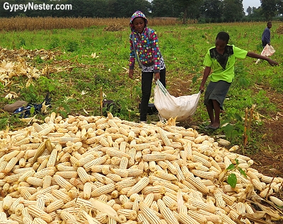
The corn meal is mixed with water to make the staple dish ugali, which serves as a huge part of the kid’s lunches.
This is served with stew or beans and is sometimes supplemented with vegetables from the school garden.
However, most of the produce that the kids help grow is sold to raise funds for the school’s operation.
We were going to Ngorongoro Crater and Tarangire National Park for safari over the weekend of our second week of teaching, returning for our last day on Monday.
Upon our return on Monday, we stopped by to say goodbye to our students and had a chance to take some “after” photos. The room looked great, the kids were happy, and we all felt satisfied with a job well done.
The Water Problem
But there was still one more thing nagging at us.
While inspecting the grounds at the beginning of our visit, we learned that the lack of running water was just a matter of hooking up to the city lines at the road.
The other plumbing was already in place within the compound.
All that was required to alleviate the need of the students transporting water from place-to-place was about a hundred yards of pipe and a connection. We were out of time to do the job ourselves, but perhaps we could leave a lasting mark on the school by providing such a basic need as running water.
As it was, the children carried the water needed to wash up and water their garden in buckets and plastic jugs.
The solution seemed simple to us, but life is much different at the school, so a combination of lack of funds and no one overseeing the maintenance of the school made the problem out of reach to the teachers and students.
Once again Jeff took the lead. He spoke with the headmistress again, who got a plumber to come take a look at the situation and give us an estimate. As we thought, it was not a huge problem, at least not to us. However, a few hundred dollars can be overwhelming for the school.
With another collection we easily gathered the funds and, by the time we returned to the States, an emailed photo showing running water at the school awaited our arrival.
The email was certainly not the only way that good feelings followed us home, we are left with lasting memories that we hold close in our hearts.

The kindness of the teachers (and the incredible work they do with so little), the feeling of making a difference and, most of all, the honor to get to know our hardworking students.
Children that we will never forget, that we will continue to hear news of through Mama Simba.

Knowing that more Discover Corps teams will pick up where we left off makes us proud – and a little bit jealous.
David & Veronica, GypsyNester.com
Delve Deeper:
See our Tanzanian volunteer vacation adventure from the very beginning
Click to see all of our adventures in Africa!
A big thank you to Discover Corps for providing this volunteer opportunity so we can share their good work. As always, all opinions are our own.
YOUR TURN: Would you consider volunteering in Africa?


 After receiving our own earfuls on several subjects from the current crop of orators, we moved on toward Kensington Gardens and the palace of the same name, but there was more to see before we could get there.
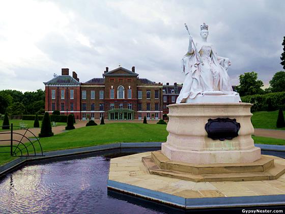

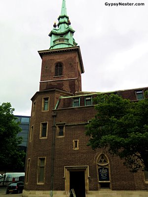 One building mostly spared by the fire is All Hallows-by-the-Tower, acclaimed as the oldest church in London. Established in 675, the church was built on the site of a Roman building. We know this because some remnants remain in the crypt.
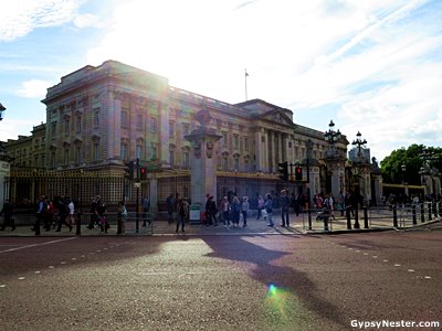 For nearly two hundred years those sovereigns have moved into Buckingham Palace after ascending to the throne. That meant we might have caught a glimpse of Queen Elizabeth, or one of her sons, Princes Andrew and Edward, who also live in the palace, but no such luck for us.
 The culmination was the album they named after the street. From then on the studio itself became known as Abbey Road. It was a little underwhelming to visit, we were only able to peer through the gates, still we couldn’t help but feel privileged by our proximity to the spot where some of the greatest music ever recorded was captured.


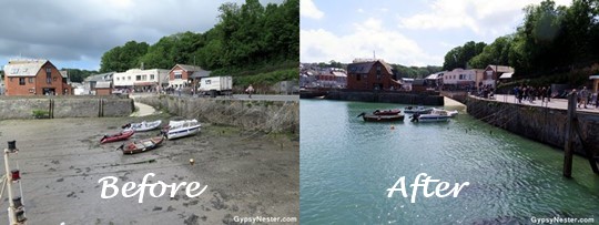
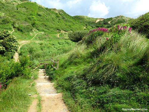 The stretch along the bay ran over and through large sand dunes that have been covered with grassy growth so that the seemingly solid ground beneath our feet was actually continually shifting.
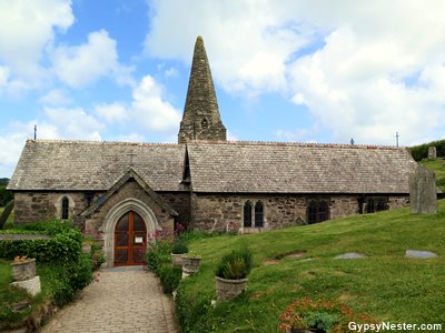 Before long we came to the enduring little Saint Enodoc Church. This stone chapel became known as Sinking Neddy because it looks as though it has sunk into the ground. But looks can be deceiving, actually it has been battling the relentless encroachment of the dunes that have continually conspired to cover it for nearly nine centuries.
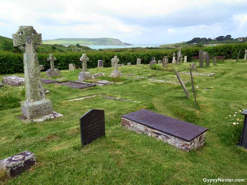 We have always been fascinated with cemeteries, the older the better, and St. Enodoc’s was mesmerizing. Not only for the markers, some of which date back to the sixteen hundreds, but for the scenic placement overlooking the bay.
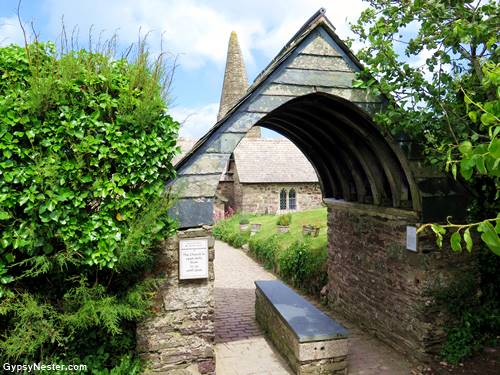 Another interesting feature of the church, which was new to us but that we would encounter many more times again on this trip, was the lychgate we passed through to enter the yard.
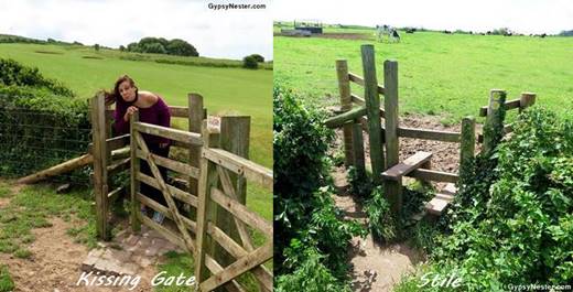

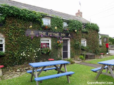 Leaving the flora and fauna behind we returned to human habitat in the pastoral village of Pityme. The name is said to come from a tragic tale of loss at sea.
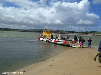
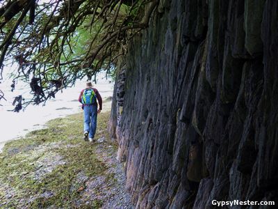 Entering the town along the beach we could see some of the namesake stones along the shoreline, even with the tide rising rapidly. Clearly, we didn’t have time to dawdle or we would be the ones asking for pity while we washed away to sea.